Platform for 3D Digital Twinning
Even the most current devices can succumb to the enormous volume of calculations required to render interactive 3D images.
Combined pressure from unrelenting technological advances and data proliferation from engineering, science, manufacturing, and facility maintenance keeps pressing the abilities of current visualization technology and makes access to the data impossible.
BujiBui stands out for its ability to retain all detail and fidelity in the data by doing the heavy and intense processing in a HPC cloud.
With Engineered Flexibility
Open architechture
Merge Static and Dynamic data.
Highly scalable
Leverage cloud-based Higher Performance Computing only when there is computational work to be done.
Customizable
Have the interface for your unique purpose.

Flexible infrastructure
Installs on public, private or hybrid environments.
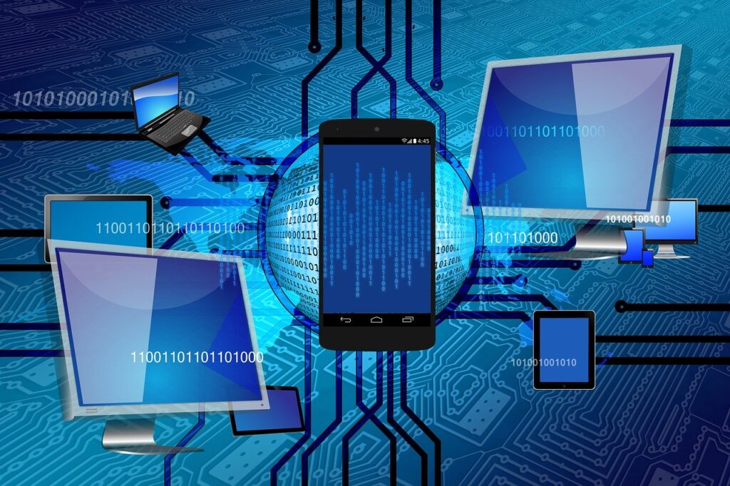
Low powered thin clients
View and interact with large data sets on smartphones, tablets or machine to machine.
Remote Connectivity
Access entire models at home, the office, or remote locations on land, in the air, or at sea.
domain integration
For the first time major technology domains are brought together on a single pltform and made accessible at home or in the field.
3D Data
Consolidate 3D data families such as CAD, Photogrammetry, LIDAR, Satellite into single views.
Non-3D Data
Feed Internet of Things data. Annotate with Enterprise Asset Management data.
Artificial Intelligence
Convert point cloud data into meshes and labeling.
Enterprise Asset Management
Integrate EAM to plan, optimize, execute, and track in a 3D context the most complex operations.
Simulations
Run Computational Fluid Dynamics (CFD) or 5G wave simulations.
Other technologies
In addition to extreme computational capability, as a platform BujiBui incorporates the most demanding technologies.
Virtual and Augmented Reality
Visualize full and minute interactive detail of structures, machinery and terrain representations for training and operations.
Geo-spatial Positioning
Integrate Simultaneous Localization and Mapping (SLAM) technology positioning to bring a new level of spatial awareness.
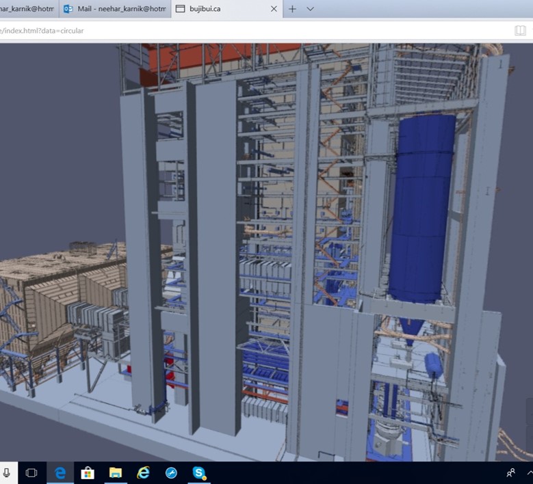
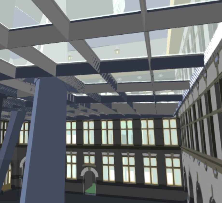
Generating the 3D Model
The first step is building the model. This involves processing raw data from various sources such as existing CAD, satellite imagery, drone collected LIDAR or photogrammetry, or bathymetry, into a 3D model consumed by downstream processes.
Automatically create 3D meshes
When 3D CAD models are not available, we use machine learning, artificial intelligence and semantic image segmentation techniques to create mesh models from point cloud data. These models are then integrated into existing CAD models or used alone. For example, “As-is” assets like pre-CAD buildings, refinery complexes, terminals and seaports.
Machine learning, artificial intelligence, and semantic image segmentation makes up a large part of the automatic model generation process.
Adding Value with Enhancements
Connecting 3D Data with Non-3D Metadata, Simulations and SLAM
Integrating Databases
The front-end can be integrated with a database in the back-end (such as IBM Maximo, Honeywell Movilizer) or a live IoT data stream.
Simulations
The 3D model is ready for practical use, or an optimized version of it can be used for running simulations. The modification or optimization of the 3D model depends on the domain and specific needs. Models are modified into ROM (Reduced Order Model) for simulation. For example, simulation of 5G waves will have different requirements than Computational Fluid Dynamics (CFD) or fire simulations.
BujiBui uses edge computing and high performance computing – Azure, AWS, GCP, IBM or a custom built HPC compute cluster.
SLAM Based Navigation System for GPS Denied Areas
When GPS is not accurate enough outdoors, and especially when operating indoors, and when precision within a few inches is required to move about safely, we use a Simultaneous Localization and Mapping, or SLAM, based navigation system together with Augmented Reality.
Visualization and Connectivity
VR, AR, Conventional Screens, and Mobile Devices
Visualization
Presentation and visual quality is relevant to the type of end uses and applications. Visualizing very large 3D data without loss of detail on thin clients is at the core of BujiBui. This makes large scale projects accessible to mobile and wearable devices. Visual quality is relevant to the type of end uses and applications.
Connectivity
Connectivity
In order for this model to be of practical use, it needs to be accessible on mobile devices via 5G, 4G, 3G or Broadband Global Area Network (BGAN) satellite broadband connections. This is where we use high performance computing which decouples the thin client’s capabilities from the size and complexity of data that you want to see. The added benefit is that BujiBui keeps the cost per user low while supporting a very large number of users.
BujiBui connects on airborne, shipborne, ground based moving platforms using BGAN (A portable satellite broadband connection with 512kbps downlink and 128kbps uplink).
Infrastructure
We can work with your existing environment or create a dedicated system
Computing
Public, Private or Hybrid High Performance Computing or conventional computing clusters are possible. Use existing infrastructure or create a new one. This will be hardware designed and architected for 3D graphics, HPC, and AI type of work. For the cloud, we can work with IBM, AWS, Azure and Google.
Data Storage
Evaluate and use existing storage systems or create an entirely new cloud system owned by you.
Database for Non-3D Data
Evaluate existing database infrastructure or consider creating a new database for 3D digital twinning. Choices can include IBM Maximo, ESRI, Honeywell Movilizer, SAP, or Oracle.
Web Server
Evaluate existing or create entirely new server.